
About the District
The Fort Bend Subsidence District was created by the Texas Legislature in 1989 as a conservation and reclamation district (Act of May 26, 1989, 71st Leg., R.S., ch. 1045, 1989 Tex. Gen. Laws 4251). The District’s purpose is to regulate the withdrawal of groundwater within the District to prevent subsidence that contributes to flooding and infrastructure damages. The District’s boundary is defined as all the territory within Fort Bend County. Several characteristics of the area raised concern about the potential for increasing subsidence in the future such as:
- Rapid growth
- Water supply dependent almost entirely on groundwater
- Proximity to significant water-level declines in Harris county
The District was formed to address measured impacts from the predominant use of groundwater. In addition to the moderate, but noticeable, amounts of subsidence, the heavy dependence of groundwater has resulted in declining water levels. Groundwater levels in wells drawing from the Chicot/Evangeline Aquifer in the northern part of the District have declined in excess of 160 feet from 1990 to 2021. (Source: 2020 Annual Groundwater Report) These declines have resulted in increased operational costs to well users and increased subsidence throughout the area.
The District utilizes a science-based, adaptive management strategy that includes groundwater regulation, a science & research program, water conservation, and collaboration carried out by our dedicated Board of Directors and staff to effectively meet FBSD’s legislative mandate.
Office Closure – July 3, 2026
The Fort Bend Subsidence District will be closed on [...]
Office Closure – June 19, 2026
The Fort Bend Subsidence District office location will be [...]
Subsidence in Fort Bend and Surrounding Counties
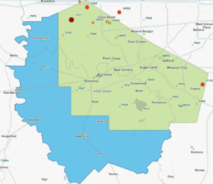
The Fort Bend Subsidence District operates GPS stations in Fort Bend county. These stations are part of a dense GPS network in the Houston-Galveston region called HoustonNet, which includes a collaboration of local and state agencies to monitor the land surface elevation. The HoustonNet comprises GPS stations operated by the following agencies.
The map above is a result of data collected each year in our Annual Groundwater Report. Once the Annual Groundwater Report has been approved by the FBSD Board of Directors, the map above will be updated with the latest subsidence rates – typically published by June.
GPS observations/data are collected at the GPS station for approximately seven days every two months. The University of Houston processes the raw GPS data and produces a time series displacement plot. The linear regression (i.e., best fit line) of the ellipsoidal height component, which essentially measures the land surface elevation, is used to determine the subsidence rate. Other collaborators on subsidence monitoring include the United States Geological Survey (USGS) and the National Geodetic Survey (NGS). A network of extensometers is maintained by the USGS to provide key insight into aquifer compaction. The NGS has been an integral partner in establishing the District’s monitoring program since the 1990s.