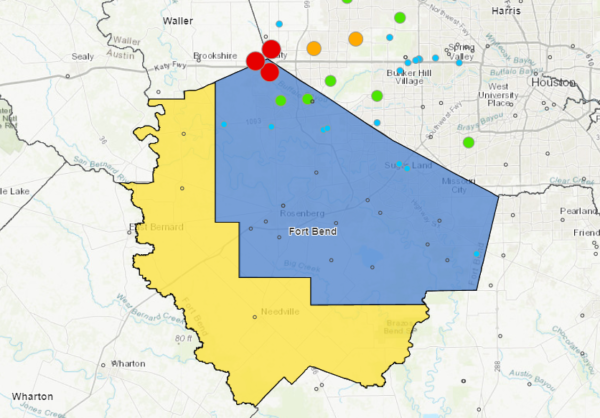
Since 1990, the Fort Bend Subsidence District has regulated groundwater withdrawals and monitored subsidence in Fort Bend county. The District has taken a reasonable approach to groundwater regulation in order to minimize subsidence within its regulatory areas. Though subsidence rates are moderate in Fort Bend county, the continued heavy dependence of groundwater use may result in increased subsidence and associated impacts such as flooding and infrastructure damage.
The District uses exceptional scientific research to ensure the best available technology and approaches are considered with respect to water management and subsidence monitoring. Types of research sponsored by the District include:
- Evaluation of projected population and future water demands
- Development of subsidence models to simulate future subsidence based on projected water demands
- Measurement of annual water-level to show the impact of conversion requirements on the water-level in the aquifer
- Assessment of alternative water supplies including brackish groundwater use and aquifer storage and recovery
Fort Bend Subsidence District Annual Groundwater Report – 2023
Each year the Board of Directors holds a public hearing for the purpose of taking testimony concerning the effects of groundwater withdrawals on the subsidence of land within the District during the preceding year.
2023 Annual Groundwater Report Public Hearing Recording | Presentation
2023 Annual Groundwater Report (coming soon)
2023 Annual Groundwater Report Executive Summary (coming soon)
ArcGIS Online Map of Subsidence Rates in Fort Bend and Surrounding Counties, Texas, USA 2019-2023 (coming soon)
Fort Bend Subsidence District Annual Groundwater Report – 2022
Each year the Board of Directors holds a public hearing for the purpose of taking testimony concerning the effects of groundwater withdrawals on the subsidence of land within the District during the preceding year.
2022 Annual Groundwater Report Public Hearing Presentation
2022 Annual Groundwater Report
2022 Annual Groundwater Report Executive Summary
ArcGIS Online Map of Subsidence Rates in Fort Bend and Surrounding Counties, Texas, USA
Fort Bend Subsidence District Annual Groundwater Report – 2021
Each year the Board of Directors holds a public hearing for the purpose of taking testimony concerning the effects of groundwater withdrawals on the subsidence of land within the District during the preceding year.
2021 Annual Groundwater Report (Final)
ArcGIS Online Map of Subsidence Rates in Fort Bend and Surrounding Counties, Texas, USA
Fort Bend Subsidence District Annual Groundwater Report – 2020
Each year the Board of Directors holds a public hearing for the purpose of taking testimony concerning the effects of groundwater withdrawals on the subsidence of land within the District during the preceding year.
2020 Annual Groundwater Report – Executive Summary
2020 Annual Groundwater Report
ArcGIS Online Map of Subsidence Rates in Fort Bend and surrounding Counties, Texas, USA
Evaluation of Projected Population and Water Demands in Fort Bend County
Final Report June 2019
EXECUTIVE SUMMARY: The Fort Bend Subsidence District (FBSD) revised its District Regulatory Plan (DRP) in 2013 based on population and water demand projections, which were developed as part of a Regional Groundwater Update Project (RGUP) completed in 2013. The RGUP was jointly supported by the Harris-Galveston Subsidence District, the Fort Bend Subsidence District, and the Lone Star Groundwater Conservation District. Population projections were developed at the census block level for each decade from 2010 to 2070 using the 2010 U.S. Census as a population baseline. Water demands were projected for individual water supply systems based on average per capita demands observed from 2000 to 2008.
In order to evaluate the performance of the projection methodology which informed the 2013 DRP, the short-term projections from the RGUP have been evaluated against recent estimates of population and water demand from multiple sources at various geographic scales. Based on this analysis, recommendations have been developed to refine the methodology used in the next regional update project to further improve the next iteration of the regulatory plan.
Evaluation of Projected Population and Water Demands in Fort Bend County
INVESTIGATION OF THE BRACKISH GROUNDWATER RESOURCES IN THE GULF COAST AQUIFER AND THE DETERMINATION OF POTENTIAL SUBSIDENCE RISK DUE TO RESOURCE DEVELOPMENT
The development of brackish groundwater resources has become a more common water management strategy in the State of Texas. Significant brackish groundwater resources exist within the Gulf Coast Aquifer System near Houston, Texas in Harris, Galveston, Fort Bend, and surrounding counties. Data were compiled and multiple hydrologic parameters were utilized to improve the understanding of the brackish resources within the study area. These data were used to develop a groundwater flow model capable of simulating subsidence to inform the subsidence risk of brackish development of the Jasper aquifer.
The results of this study confirm the potential for compaction in the Jasper aquifer and subsidence to occur from brackish groundwater development particularly in up-dip areas near where the Jas-per is being used for freshwater supply. This study provides a basis for future research on subsidence in the Districts’ area and can inform water managers and planners in the Houston area on the availability of brackish groundwater resources.
Subsidence Risk Assessment and Regulatory Considerations for the Brackish Jasper Aquifer
Fort Bend Subsidence District Science and Research Plan (2015)
The District Science and Research Plan represents the “strategic direction” for science and research conducted or supported by the Fort Bend Subsidence District (FBSD) and, as such, is an essential component of the Districts regulatory planning process. The Science and Research Plan is designed to be a dynamic document with the intention to provide clarity to the strategic direction of the District and guidance to future science and research priorities in support of the District Regulatory Plan.
Water-Level Measurement Data Collected during 2015-2016 and Approximate Long-Term Water-Level Altitude Changes of Wells Screened in the Chicot, Evangeline, and Jasper Aquifers, Houston-Galveston Region, Texas.
The U.S. Geological Survey, in cooperation with the Harris Galveston Subsidence District, City of Houston, Fort Bend Subsidence District, Brazoria County Groundwater Conservation District, and Lone Star Groundwater Conservation District, has produced this dataset of water-level changes and approximate water-level altitudes in the Chicot, Evangeline, and Jasper aquifers in the Houston-Galveston region, Texas. This dataset shows current-year (2015-2016) water-level changes for each aquifer, 5-year (2011-2016) water-level changes for each aquifer, long-term (1990-2016 and 1977-2016) water-level changes for the Chicot and Evangeline aquifers, and long-term (2000-2016) water-level changes for the Jasper aquifer. The water-level measurements in the dataset are built upon and stored in the National Water Information System: web interface, groundwater information, and field measurements website located here: http://dx.doi.org/10.5066/F7P55KJN. This site is a publicly available, searchable, online database of water information.
Kasmarek, M.C., and Ramage, J.K., 2016, Water-Level Measurement Data Collected during 2015-2016 and Approximate Long-term Water-Level Altitude Changes of Wells Screened in the Chicot, Evangeline, and Jasper Aquifers, Houston-Galveston Region, Texas: U.S. Geological Survey data release, http://dx.doi.org/10.5066/F77H1GP3.
InSAR Monitoring
The Harris-Galveston Subsidence District, in cooperation with the Fort Bend Subsidence District, the Brazoria County Groundwater Conservation District, the Lone Star Groundwater Conservation District, the University of Houston, and the Brazosport Water Authority maintains a subsidence monitoring network that is constantly evolving and requires consistent investment. The network, initiated in 1994, currently extends across the Houston-Galveston region, across Harris, Fort Bend and surrounding counties, in an effort to represent the breadth and scope of subsidence in the region.
Since 2019, the Subsidence District has sponsored research conducted by Southern Methodist University (SMU) that utilizes a novel methodology to evaluate land-surface deformation (subsidence) in the region. This study, spawned from their original research that showed subsidence in southern Montgomery County was caused by exploitation of the Jasper aquifer, will investigate the combined effects of climate changes on coastal subsidence to enhance understanding of the deformation process. SMU is developing subsidence maps from 1992 to 2023 by integrating data obtained from multi-temporal Interferometric Synthetic Aperture Radar (InSAR), a remote sensing technique using data collected from orbiting satellites, to quantitatively evaluate subsidence over specific periods of time across the region.
After successfully implementing InSAR mapping in the Houston-Galveston region in 2019, this new project will harness the complimentary capabilities of the Subsidence District’s subsidence monitoring network and SAR imagery to develop these historical deformation maps.
Project Schedule
- Project Initiation: January 2020
- 2019-2021 Final Report: October 2022
- 2022-2023 Final Report: TBD
Project Deliverables
The Harris-Galveston Coastal Subsidence District/National Geodetic Survey Automated Global Positioning System Subsidence Monitoring Project
A report by: David B. Zilkoski, Lucy W. Hall, Gilbert J. Mitchell, Vasanthi Kammula, Ajit Singh, William M. Chrismer, and Ronald J. Neighbors.
Fort Bend Subsidence District Annual Groundwater Report – 2019
Each year the Board of Directors holds a public hearing for the purpose of taking testimony concerning the effects of groundwater withdrawals on the subsidence of land within the District during the preceding year.
2019 Annual Groundwater Report
2019 Annual Groundwater Report Appendix A
Fort Bend Subsidence District Annual Groundwater Report – 2018 (vol. 29) Final
Each year the Board of Directors holds a public hearing for the purpose of taking testimony concerning the effects of groundwater withdrawals on the subsidence of land within the District during the preceding year.
Fort Bend Subsidence District Annual Groundwater Report – 2017 (vol. 28)
Pursuant to Fort Bend Subsidence District (the District or FBSD) Resolution No. 18-396 passed on March 28, 2018, the Board of Directors held the Annual Groundwater Hearing beginning at 2:30 p.m. on May 23, 2018. The public hearing fulfills the requirements of the Districts enabling legislation, which states that the Board of Directors shall hold a public hearing to take testimony concerning the effects of groundwater withdrawals on the subsidence of land within the District during the preceding year. This report documents the impact of groundwater use on aquifer water levels and subsidence within the District and was prepared in accordance with an Inter-local Agreement between the District and the Harris-Galveston Subsidence District (HGSD).
Regional Groundwater Update Project – Final Report (2013)
The purpose of this report is to summarize the results of the Regional Groundwater Update Project (RGUP). The RGUP originally started in 2010 as the Harris-Galveston Subsidence District (HGSD) 1999 Regulatory Plan Update, but due to its benefits to other regional groundwater regulatory agencies, the Fort Bend Subsidence District (FBSD) and the Lone Star Groundwater Conservation District (LSGCD) joined the collaborative effort in 2010.The primary benefit of collaboration between these three entities is that each of them could use the RGUP to vet their existing regulatory plans using updated population/water demand data and groundwater modeling capability, and in the case of HGSD and FBSD, investigate the physical effects of changing their existing regulatory plans to accommodate the practical realities facing their stakeholders while successfully completing the Districts mission objectives.


